


Description
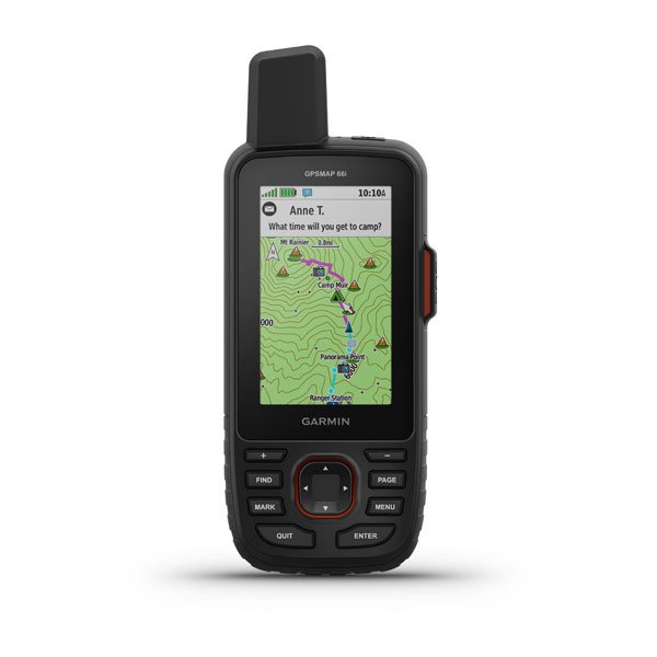
Garmin GPSMAP 66i Handheld GPS
Garmin GPSMAP 66i Handheld GPS
GPS Handheld and Satellite Communicator
Precise navigation meets global communication in the rugged GPSMAP 66i button-operated GPS handheld and satellite communicator featuring Garmin TopoActive mapping and inReach technology.
Specs:
Maps & Memory - PRELOADED MAPS (TopoActive & Routable) - ABILITY TO ADD MAPS - BASEMAP - AUTOMATIC ROUTING (TURN BY TURN ROUTING ON ROADS) - MAP SEGMENTS 15000 - BIRDSEYE (Direct to Device) - INCLUDES DETAILED HYDROGRAPHIC FEATURES (COASTLINES, LAKE/RIVER SHORELINES, WETLANDS AND PERENNIAL AND SEASONAL STREAMS) - INCLUDES SEARCHABLE POINTS OF INTERESTS (PARKS, CAMPGROUNDS, SCENIC LOOKOUTS AND PICNIC SITES) - DISPLAYS NATIONAL, STATE AND LOCAL PARKS, FORESTS, AND WILDERNESS AREAS - EXTERNAL MEMORY STORAGE (32 GB max microSD card) - WAYPOINTS/FAVORITES/LOCATIONS 10000 - TRACKS 250 - TRACK LOG 20000 points, 250 saved gpx tracks, 300 saved fit activities - ROUTES 250, 250 points per route; 50 points auto routing - RINEX LOGGING
Specs:
- PHYSICAL DIMENSIONS 2.5” x 6.4” x 1.4” - DISPLAY SIZE 1.5"W x 2.5"H; 3" diag - DISPLAY RESOLUTION 240 x 400 pixels - DISPLAY TYPE transflective color TFT - WEIGHT 8.1 oz with batteries - BATTERY TYPE rechargeable, internal lithium-ion - BATTERY LIFE up to 35 hours at 10-minute tracking Up to 200 hours at 30-minute tracking (power save mode) - WATER RATING IPX7 - MIL-STD-810 yes (thermal, shock, water) - HIGH-SENSITIVITY RECEIVER Yes - INTERFACE high speed micro USB and NMEA 0183 compatible - MEMORY/HISTORY 16 GB (user space varies based on included mapping)
Maps & Memory - PRELOADED MAPS (TopoActive & Routable) - ABILITY TO ADD MAPS - BASEMAP - AUTOMATIC ROUTING (TURN BY TURN ROUTING ON ROADS) - MAP SEGMENTS 15000 - BIRDSEYE (Direct to Device) - INCLUDES DETAILED HYDROGRAPHIC FEATURES (COASTLINES, LAKE/RIVER SHORELINES, WETLANDS AND PERENNIAL AND SEASONAL STREAMS) - INCLUDES SEARCHABLE POINTS OF INTERESTS (PARKS, CAMPGROUNDS, SCENIC LOOKOUTS AND PICNIC SITES) - DISPLAYS NATIONAL, STATE AND LOCAL PARKS, FORESTS, AND WILDERNESS AREAS - EXTERNAL MEMORY STORAGE (32 GB max microSD card) - WAYPOINTS/FAVORITES/LOCATIONS 10000 - TRACKS 250 - TRACK LOG 20000 points, 250 saved gpx tracks, 300 saved fit activities - ROUTES 250, 250 points per route; 50 points auto routing - RINEX LOGGING